Most Beautiful and Unique Hiking Trails in Indiana
A hub for several major interstate highways that criss-cross the state, Indiana is known as the “Crossroads of America”. In addition to its roadways, Indiana is also home to more than 4,000 miles of established nature trails that take in many of the state’s most beautiful natural assets.
Indiana offers up residents and visitors numerous national and state parks as well as nature reserves and national forests. These protected natural areas provide a mix of hiking, mountain biking, off-road vehicle, horseback riding, snowmobiling, and kayak trails. We thought we’d take a deeper look into Indiana’s top hiking trails.


Never has there been a more opportune time to explore Indiana’s natural outdoor beauty, since safe social distancing activities seem to be what many people are seeking these days. Whether you’re into searching for wildlife or simply admiring stunning natural landscapes, Indiana offers a wide variety of different hiking trails ranging from walks that take a few hours to multi-day treks.
Indiana has also launched a digital State Nature Passport reward program that is available to both residents of Indiana and visitors. Signing up to the program will award you with prizes such as sunglasses, hats, or water bottles when you check in with your smartphone to various parks and reserves and visit their iconic landmarks. You can even go into drawings to win prizes like annual park passes and gift cards.
This program is giving even more incentive for people to get out and experience the popular hiking trails that pass through many of the best places to explore in Indiana.


Indiana’s Top Hiking Trails
Adventure Hiking Trail
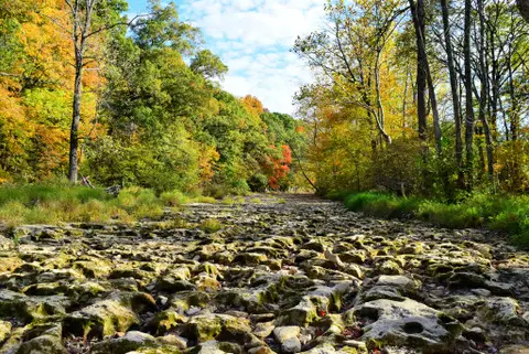
Located in Corydon just north of the Kentucky border is the roughly 22-mile Adventure Hiking Trail that passes through both O’Bannon Woods State Park, which is home to the Wyandotte Caves, as well as Harrison-Crawford State Forest. The trail also makes up a portion of the American Discovery Trail.
The trail can be a bit challenging for some, with considerable elevation changes and sometimes muddy tracks being the main challenges. The trails are very well marked, although some care is needed to avoid mixing up the main looping trail with the various horse trails that intersect it.
The trail is best spread out over 2-3 days, with several overnight shelters available to hikers on a first come, first serve basis. You should also plan to carry plenty of water or place water caches at the various drop off-pick up locations along the trail that are accessible by roads.
Most hikers choose to walk the Adventure Trail during the spring and summer months, with April being especially rewarding due to the many wildflowers in bloom. The views of the Ohio River and panoramic vistas from the ridges are always a highlight.


Cowles Bog Trail
Heading up to the north-western part of the state, Indiana Dunes National Park offers up the popular Cowles Bog Trail. Named after botanist and ecologist Henry Chandler Cowles who studied the area’s plant life including its special dune vegetation, the Cowles Bog Trail offers nearly five miles of hiking.
Three different looping trails are all accessible from the main trailhead, allowing hikers to select shorter versions of the larger full hike. Hikers that choose the longest loop will be awarded with views of Lake Michigan and traversing the dunes. The remote beach, which you may have all to yourself at times, offers a great midway break and possible refreshing dip during the heat of the summer.
The roughly 4-hour hike will introduce you to a wide variety of plants for which the park is famous for including ferns, blue lupine, black cherry trees, orchids, and prickly pear cactus which may seem a bit out of place. You may also encounter beavers and deer as well as many bird species including wading birds which can be found near the lakeshore.
The plant life of Indiana Dunes National Park, one of America’s newest national parks, is recognized as a National Natural Landmark. It’s hard to believe this beautiful natural gem is just 45 minutes from busy Chicago which lies just across the border with Illinois.
While May through October is the most popular time to hike the trail, the park is accessible year-round, with snowshoeing a fun activity to try during the winter. Those wanting a shorter and much easier trail within Indiana Dunes National Park can look to the west end of the park with the Paul H. Douglas Trail. This trail also passes along the shoreline of Lake Michigan and is an equally good spot for observing wildlife.


The Knobstone Trail
Those wishing to tackle Indiana’s longest hiking trail can sink their hiking poles into the soil of the Knobstone Trail. This trail can currently be accessed by seven trailheads and the length of the trail seems to only be getting longer and longer every year. At present, the length of Knobstone stands at just shy of 60 miles, but there are plans to extend this by more than double its current length by connecting it with other trails.
This challenging trail winds its way through the Clark State and Jackson-Washington State Forests, presenting hikers with plenty of steep climbs and descents. It covers three different counties in the state before terminating at its southern end just over a dozen miles from the Kentucky border.
You should plan on the trail taking you four days to complete and it’s advisable to plan water caches unless the creeks are flowing and you have a way of sterilizing the natural water. Primitive camping is allowed, but make sure to check the trail conditions before you set out in case of any closures.
Cool Creek Park’s Beech Trail
Just north of Indianapolis in the city of Carmel which many consider to be the “Roundabout Capital of the U.S”, is a much tamer hiking experience than the Knobstone Trail. The family-friendly trails of Cool Creek Park offer a mix of woodland trails as well as a paved loop for cyclists.
The 1-mile Beech trail is the “Goldilocks trail” since its length is in-between the longer 1.5 Tulip Trail but double the length of the .5-mile Paw-paw Trail. A footpath runs along each side of the shallow creek allowing for easy access and providing younger kids with entertainment as they chase tadpoles and minnows. Beech trail, along with the others within this 90-acre park, are mostly flat, easy to manage, and open from dawn to dusk.
The park is considered to be the best place in Central Indiana for observing migrating birds during the spring and fall, with the park’s nature center offering up plenty of information and displays that focus on the park’s wildlife. There are also picnic shelters, sporting fields, and a playground


Pokagon State Park’s Hell’s Point Challenge
Pokagon State Park is known for offering great winter activities such as cross-country skiing and tobogganing, but many people come all year long to enjoy the park’s hiking trails. In an effort to encourage native “Hoosiers” from Indiana as well as visitors to get active outdoors, the park created an 8-mile trail named Hell’s Point Challenge.
While the trail may sound ominous, it’s pretty moderate in terms of a hiking challenge. The hike should take you between three and four hours to complete, with those that do finish the looping-trail challenge receiving a free water bottle and sticker stating they “Hiked It & Survived It”.
The trail begins at the Pokagon State Park Nature Center and you must collect photographs with your phone or camera of six waypoints along the route to prove you made it around the trail, showing your evidence to a ranger at the nature center upon your completion. Waypoints include Lake Lonidaw, the Potawatomi Nature Preserve where you may spot wildlife, and Hell’s Point with its heart-pumping 80+ steps.
You can tackle the challenge during any season and the free gift offer for completing the challenge is said to be ongoing. You can choose to do the loop in a clockwise direction, saving the challenging parts for the second half of the hike, or in a counter-clockwise direction to get the challenging portions out of the way early on.


Turkey Run State Park’s Trail 3: “The Ladders”
Head to Turkey Run State Park in the state’s west to experience a unique hiking experience. Home to 11 different trails of varying length and difficulty, you can choose to hike single trails or group a few together to form your own personalized loop.
One of the most unique trails is Trail 3 which is known as “The Ladders” due to the fact you’ll actually get to climb a series of ladders along the way as you make your way up to the ridgeline section of the trail.
The trail runs along Sugar Creek, passing attractions such as Bear Hollow and the Punch Bowl which was carved out by past glacial activity. The trail is about 1.7 miles in length and considered to be very rugged due to the climbing that’s involved.
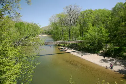
When you’re done exploring the park’s deep canyons and sandstone cliffs, you can check out the many 19th century historic sites including a covered bridge, abandoned coal mine, log church, and the state’s oldest timber cabin. There’s also a fun suspension bridge you’ll cross to reach most of the hiking trails.
Please check trail conditions ahead of time since they may become impassable during high water levels from recent snow melt or heavy rains, and because this trail can be challenging, make sure you take a comfy daypack for hiking.
Daniel Schwen, CC BY-SA 4.0 Wikimedia Commons
Charlestown State Park’s Rose Island Trail
One of the state’s newer parks, Charlestown State Park offers a hiking trail that winds its way through an old abandoned amusement park that once existed on the park’s Rose Island. The amusement park once featured a large Ferris wheel, pool, and zoo but was left to decay after a flood in the 1930’s saw it covered in ten feet of water.
The remnants of the old amusement park can be accessed via Trail 3 and the historic Portersville Bridge which crosses Fourteenmile Creek to get to Rose Island. The creek flows into the Ohio River which in turn flows around part of the island. While there aren’t a lot of structures that remain, interpretive signs explain where things once stood and what the various remains you see are.
In total, roughly 14 miles of hiking trails varying from moderate to rugged are available in the park. The park is home to what is said to be the state’s oldest unglaciated stream valleys, which you’d be forgiven for not understanding or really appreciating what that exactly means. What is easy to appreciate is the park’s river and creek views, cliffs, waterfalls, fossils, and sinkholes. If you’re into birdwatching, keep an eye to the sky for soaring bald eagles and ospreys that hang out near the creek and river.